KQ PDIMS (KQ Pipeline Devices Information System) provides a comprehensive solution for utilities management in a geospatial environment. Through KQ PDIMS, you can visualize, manage, and analyze your utilities network from an intuitive map interface. This is a customizable system that is able to be built on more advanced applications.
System Functions:
Database Management
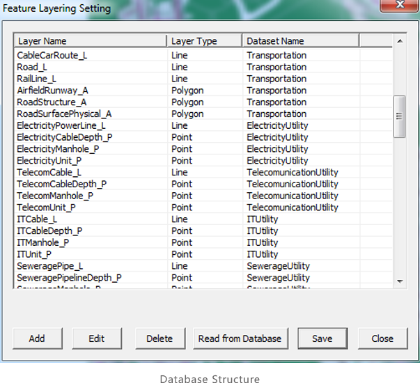
KQ PDIMS integrates a sophisticated utility database structure which has been proved in many utility management projects. And modifications on this database structure are also supported.
Data Editing
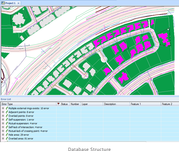
Users can draw pipelines and pipe points, and edit their attributes. Moreover, sufficient digitizing tools are also provided to collect and check background geographical features, like buildings, roads, rivers, etc.
Mapping
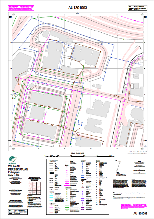
This system supports template mapping. Users can customize map template according to them specific requirements.
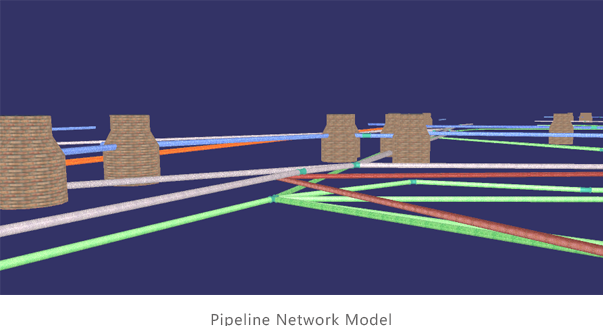
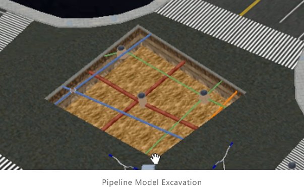
3D Modeling
3D pipeline models can be batch generated automatically from vector data based on program rules. Even the most complex pipeline network junction point can be processed perfectly.
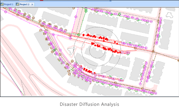
Utility Analyses
These analyses help users to understand their pipelines and surroundings. Make smarter decisions that secure pipeline assets integrity and safety.
 (8610)85271488


 KQ PDIMS
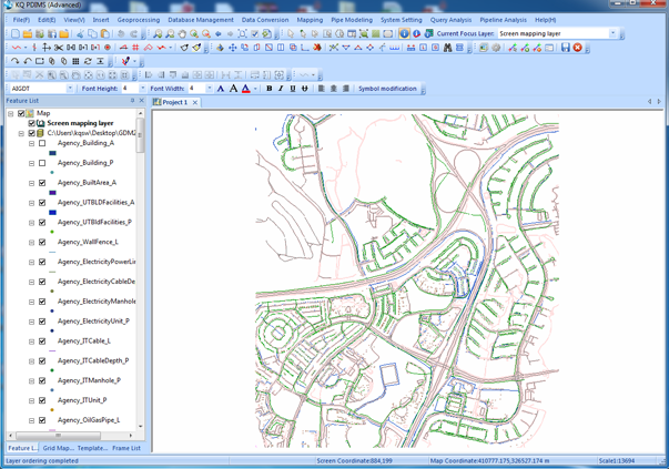
 (8610)85271488
 Service Network
 Join Us
 current position: