 KQGIS Desktop
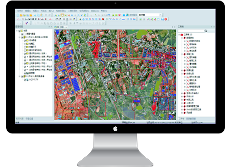
KQGIS Desktop is a professional spatial data production, management and application software in China. This platform can achieve complex processing and 2D-and-3D-integrated management of big spatial data and conduct data digitizing, data conversion, data editing, data quality checking, data processing, data storage, mapping, data analysis etc. It is capable of carrying out large-scale GIS application system construction in all industries.
Features:
 Multi-format Source Data Digitizing: multiple data digitizing methods, which supports data exchange among multiple formats such as CAD, VCT, ARCGIS etc.
 High-efficient Data Quality Checking and Batch Processing: perfect data checking program, which supports manual processing and batch processing of data errors in order to improve working efficiency.
 2D-and-3D-integrated Analysis: 2D and 3D interactive analysis; extending data application into 3D delicacy management.
 Powerful Topological Analysis Processing: rapid spatial topological relation processing capacity, which guarantees precise and standard data spatial position relation so as to improve data quality and reliability.
 Convenient and Simple Deployment: easy operation and installation, which saves installation time and disk space.
KQGIS Mobile
KQGIS Mobile is a professional mobile development platform embedded with GIS software, based on the features of mobile devices. This platform provides comprehensive GIS functions including data browsing, data collection, data editing, data query, data quality checking, data storage, data doodling etc. It also supports mobile GIS application development of online or offline data.
KQGIS Mobile is divided into two kinds according to different application requirements: survey-oriented and navigation-oriented.
 Survey-oriented: able to accomplish field navigation, project survey, construction lofting, GIS data collection and other tasks.
 Navigation-oriented: able to offer E-map browsing, locating, navigation, interest points search, path search etc.
 (8610)85271488


 KQGIS Server offers all-round 2D-and-3D-integrated network services, which realizes management and publishing of massive and distributive 2D&3D spatial information as well as multi-scale, multi-source and multi-format spatial information sharing. This platform is widely applied in spatial information data sharing and application among internal departments of government and enterprises, vertical management units and industries.
GIS平臺-英文.png)
.png)
 (8610)85271488
 Service Network
 Join Us
 current position: